Derwent Valley Skyline Solo Hike | 46-50 km
- bootsandbanter

- 1 day ago
- 11 min read
A story about expectations colliding with reality
Distance isn't always the hardest part
Date: 30 May 2026
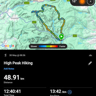
📍Route: Ashopton > Crook Hill > Bridge-end Pasture > Rowlee Pasture > Alport Castles > West End Moor trig > Alport Moor > Bleaklow Stones > Bleaklow Head > Grinah Stones > Barrow Stones > Swains Greave > Swains Head > Featherbed Moss > Hoar Stones - Howden Edge > Outer Edge > Margery Hill > Wilfrey Edge > Howden Edge > High Stones > Wet Stones > Round Hill > Cartledge Stones Ridge > Back Tor > Dovestone Tor > White Tor > Wheel Stones > Whinstone Lee Tor > Ashopton
📏Distance: 46 - 50 km (varied calculations from the Garmin watch and the GPS device)
⬆️Ascent: 1054 m
⌛Time: 12 hours 40 minutes
Weather: Sunny, very warm
Mood: optimism, confusion, relief, effort, relief, determination
The Derwent Valley Skyline is a serious moorland circuit in the Dark Peak region of the Peak District National Park. It is a varied and demanding route, often traversing difficult terrain which necessitates competent navigational skills. The route deserves respect. I have extended the walk to cover even more ground and reached 6 ethels and 4 trigs.
Original Route & Making a Long Day Longer

This hike only made it onto my list earlier this year. I can't remember exactly how I came across it, but I found the original Derwent Valley Skyline route and then immediately decided to make it longer. (!)
The original route doesn't visit Bleaklow Head. My logic was simple enough that if I'm already in the area, I might as well go and collect it. I knew I needed a long summer day for this one. OS Maps estimated 43.5 km and around 12.5 hours. In my head, this was basically a longer version of the Dambusters Challenge which I completed in April (read here). I'd even covered some of the terrain before.
My expectations were spectacularly wrong.
Going It Alone
I don't take long-distance challenges lightly. I knew it would be hard mentally, but that's usually something I can deal with. I often compare things to the hardest day I've had in the hills so far, the Welsh 3000s in 24 hours (see here leg 1, leg 2, leg 3). The difference this time? I was on my own. No group. No support. No route-finding by somebody else. Just me, a GPS and a very long day ahead. Only 4 days after finishing my 3-day Lake District hiking trip(see day 1, day 2, day 3), I decided I was fully recovered and ready to go.
Whether that was true remains open to debate. Still, I set off believing this would be manageable. Difficult, yes. Long, definitely. But nothing outside my comfort zone.
After all, I'd completed the Welsh 3000s. I'd finished the Dambusters Challenge. I have done 4 out of 12 Edale Skyline so far in 2026. I'd spent years building up experience in the hills. I trusted my fitness, my navigation, my ability to read the ground and my ability to keep putting one foot in front of the other.
What I hadn't fully appreciated was that there is a different kind of challenge in spending almost 13 hours alone with your own thoughts, making every decision yourself, carrying the full weight of the day from start to finish in an area like the Dark Peak.
The Derwent Valley Skyline had plenty of opportunities to remind me of that.
A Sunny Start

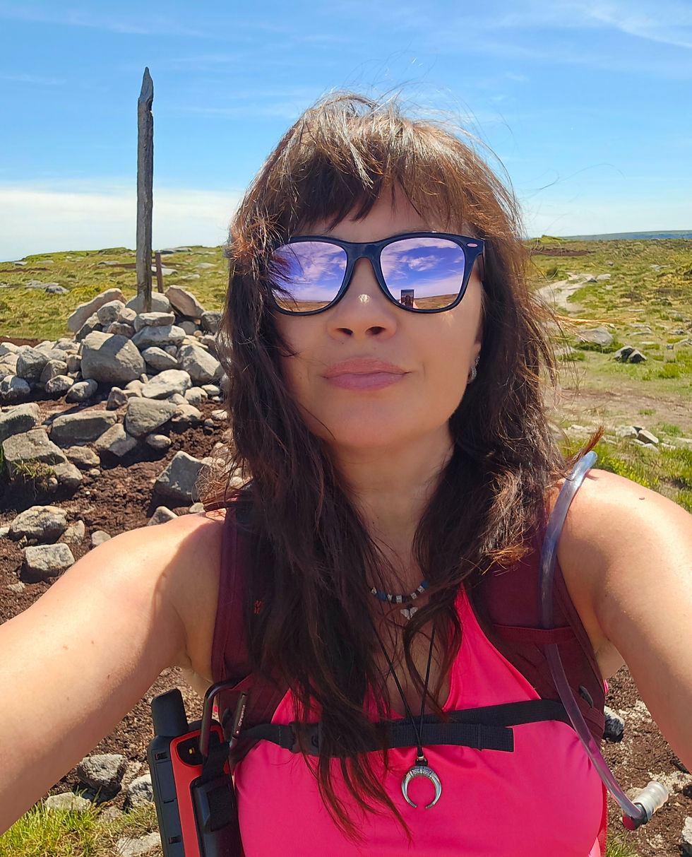
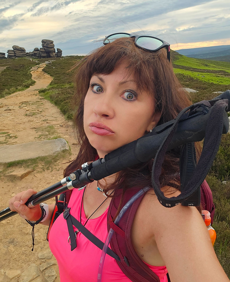
The day began as most good hiking days do. Favourite songs. Loud singing. An hour and a bit driving towards Ladybower with blue skies and sunshine. I parked at Ashopton, just before Snake Pass, and was pleasantly surprised to discover the parking bay was free.
The forecast was excellent. No rain all day. Light winds. Sunshine. Of course, I've spent enough time in the Lakes, Wales, Bulgaria and elsewhere to know that weather forecasts occasionally tell little white lies, so a lightweight jacket still went into the bag.
I set off in a vest carrying 3 litres of water and 500 ml of isotonic drink, slightly concerned about whether it would last, 1 sandwich and couple of snacks. 20 min later I encountered my first obstacle. It was sheep, large male sheep, several of them. All lying directly across the gate where the path went. I spent 10 to 15 minutes trying to find another way through before eventually admitting defeat and approaching the nearby farmhouse. The farmer's wife looked mildly irritated at first, then I explained my predicament. "I am being held hostage by sheep" probably wasn't the explanation she expected that morning. She smiled and allowed me through.
Alport Castles - Familiar Ground Ends
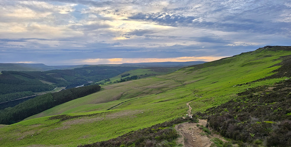
The walk towards Alport Castles was familiar territory. Crook Hill was Ethel number 1 of 6 for the day and a summit I'd visited before. The weather was glorious, the views were excellent, the crowds were non-existent. 9 kilometres into a very long day, things were going nicely.
Past Alport Castles I entered completely new ground. I noticed bog features everywhere, though thankfully the dry spell had rendered most of them harmless.
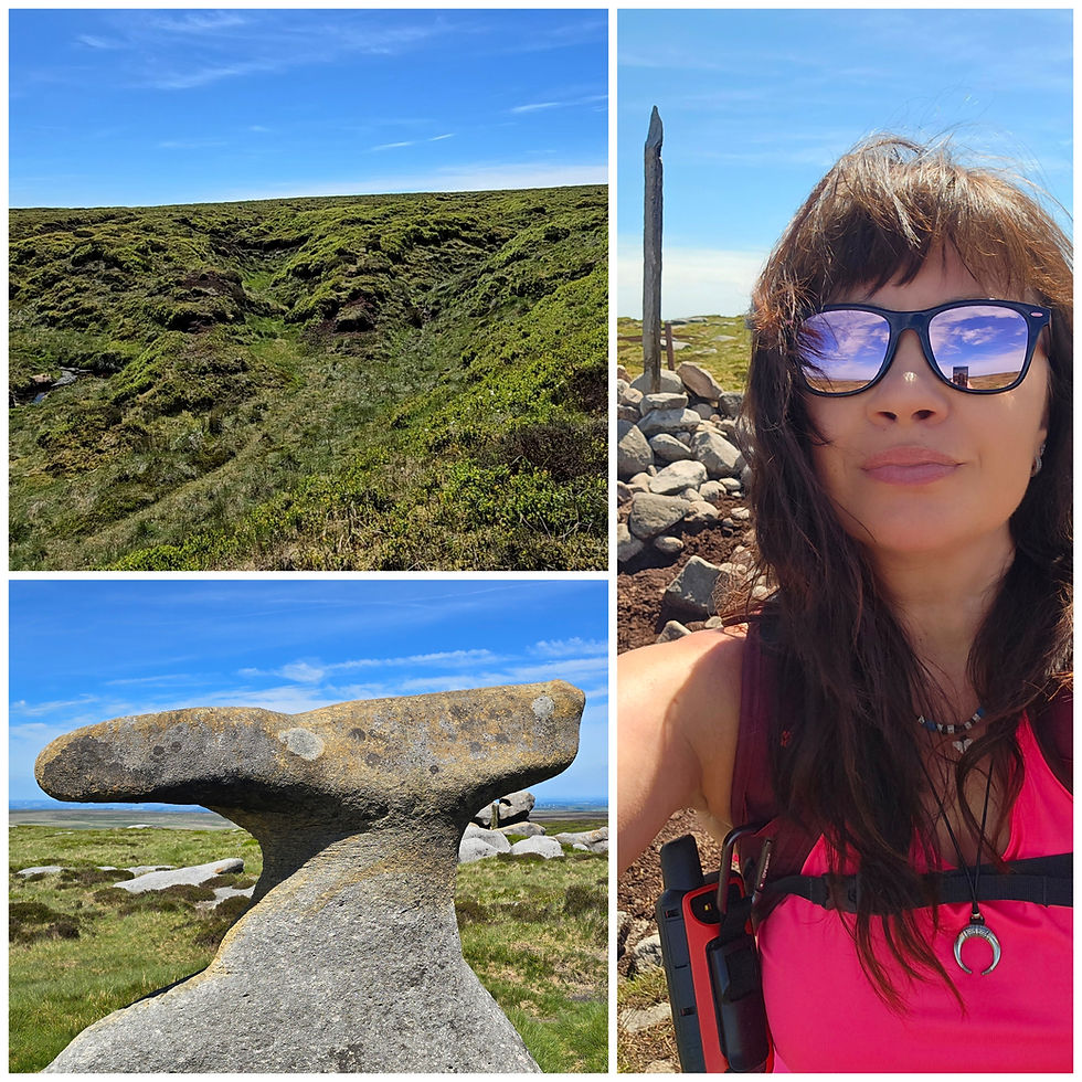
Around 12 km in I reached West End Moor Trig Point, my 73rd trig of 87 and 1st one for the day. It sits in the middle of absolutely nowhere. Everything looked identical, just endless moorland. Alport Moor followed shortly afterwards, it was a new one for me - ethel number 86 of 95 and ethel number 2 for the day. The summit is marked by absolutely nothing. If somebody removed the GPS coordinates, I doubt I'd ever know I'd reached it.
Up to this point I was feeling quite smug about the dry conditions. This terrain would be a very different experience in the wet. Even in perfect conditions the paths were little more than rumours. You spend much of the time staring at the ground trying to work out whether the faint line ahead is actually a path or merely a suggestion.
Into the Moors
The route towards Bleaklow Stones is going through The Ridge and improved slightly in terms of visible paths. I met exactly one runner and this was the extent of human interaction. 4 hours in and I seen 4 people (3 at Alport Castles).
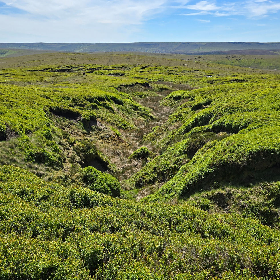
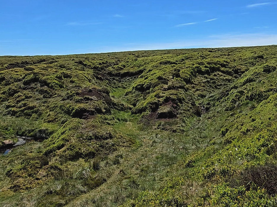
As I climbed Westend Head, the scenery changed. There were vast carpets of bright green bilberry stretched into the distance. I remember thinking how incredible this place would be in August. Then the groughs appeared. At first they seemed interesting, a bit different. I didn't yet realise they would become my constant companions for the next three hours.
Ignorance truly is bliss.
Because I Was Already There - Enter Bleaklow
Around kilometre 17 I reached Bleaklow Stones. It was approximately 1 pm and I'd already been walking for 4.5 hours. I didn't linger because my self-inflicted Bleaklow Head diversion still lay ahead.
The original route doesn't go there. My route did. This proved to be one of the less intelligent decisions of the day. If you've never encountered Bleaklow's groughs, imagine enormous labyrinthine trenches carved into deep black peat. Some are waist-deep. Some are probably deeper.
The moment you drop into one, all sense of perspective disappears. The GPS line on my Garmin device and reality become two entirely separate things. I frequently wasn't following my plotted route at all. Sometimes because a grough blocked the way, sometimes because something on the ground looked like a path, sometimes because I simply hoped it was. The GPS line remained reassuringly nearby while I wandered around in roughly the same postcode.
Eventually I reached Bleaklow Head, Ethel number 87 a new one for me and ethel number 3 for the day. I sat down and ate my sandwich, enjoying 10-15 peaceful minutes. Couldn't relax too much though as I had to go back through all of it again. Wonderful.
The Reality of Bleaklow
The diversion was only 5 km but on Bleaklow, distance is irrelevant. I wouldn't have added this detour if I'd known what awaited. I have encountered similar landscape when I was on Kinder Scout plateau last year and I said to myself then "Never again!"
Bleaklow area has a reputation, which I did read about fully after the hike (!). I understand that reputation now. I would only recommend anyone attempt it during a prolonged dry spell. Whether I voluntarily return to this area remains uncertain. However, I later discovered that Higher Shelf Stones, an Ethel I designated long ago as my final Ethel of the Ethel Challenge, sits within this same stretch of Bleaklow. So I will be ending the challenge in a place that is, in every sense, unforgettable. Possibly for all the right reasons, possibly not.
The Route Goes Wrong - Grinah Stones mistake

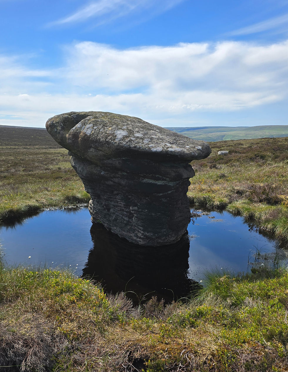
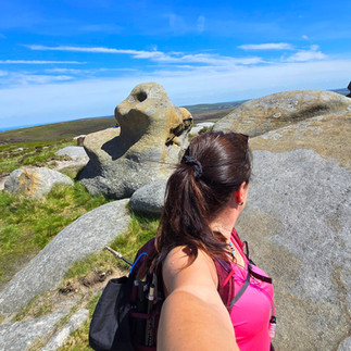
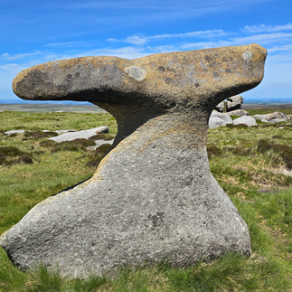
Back at Bleaklow Stones, I genuinely believed the hardest part was behind me. This assumption lasted approximately half an hour. I took a few pictures of the weirdly shaped stones and I headed towards Grinah Stones and about 1 km in I realised I wasn't actually following my planned route anymore.
At this point I made another decision, fuelled by optimism rather than intelligence. Instead of retracing my steps, I decided it would be perfectly reasonable to continue exploring and find another way. After all, how difficult could that be?
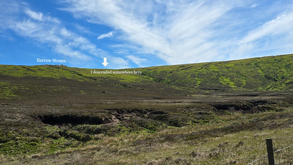
Fully Off Course - Barrow Stones

Reader, it was difficult.
I wandered north towards Barrow Stones and soon found myself completely detached from my plotted route. No paths. No people. No sign of civilisation. The GPS line sat somewhere in the distance like a disappointed parent. Barrow Stones are well spread out. I walked through the stones, some of which have interesting shapes, I couldn't spot even 1 path there though. I must have been on the wrong side as I read after there was something like a path on the East side.
I got a bit apprehensive in the area due to how remote it feels and decided to work my way back towards my GPS line, somewhere North.
The Escape Through Swains Greave
This involved descending directly into Swains Greave through dense heather. Very dense heather. Knee-high in places. I was wearing shorts, and I couldn't see where my feet were landing. The poles helped, mostly by confirming there was something underneath the heather, though exactly what that something was remained a mystery. I also had intrusive thoughts about snakes for some reason, which didn’t help, so I had to actively compose myself and just keep moving.
For the next two to three kilometres I fought through vegetation, crossed boggy ground, and generally questioned why have I not retraced the steps back to the plotted route earlier.
Eventually, a small wooden stile appeared. I've never been so pleased to see a piece of timber. A faint path followed, then Swains Head, and finally my GPS line.
Relief. Sweet relief.
Strava’s heatmap later confirmed what I already suspected in my bones that the line I took was basically the only line on that side of the slope. Seeing it properly mapped out afterwards didn’t make it feel better, just more official.
Featherbed Moss Says Hello
I thought the worst was over. Again. Unfortunately the route had other ideas. Ahead lay Featherbed Moss, Howden Edge, and several kilometres of more featureless open moorland.
The next 6 kilometres blur together in my memory. Just endless stomping. Faint paths appearing and disappearing. Peat. Grass. More peat. More grass. Eventually I reached Outer Edge Trig Point - trig number 2 for the day. Mentally I was exhausted. I had been here before, and I also remembered exactly what awaited between Outer Edge and Margery Hill.
Tussocks, bogs, and the kind of ground that looks solid until you test it with a pole and discover your walking pole has disappeared into the earth like a spoon into soup. One particularly memorable grough required a descent of what felt like four metres before I could climb back out the other side.
Eventually I reached Margery Hill, Ethel number 4 and trig number 3 for the day, with 32 kilometres completed. At that point I had only one objective: get to Back Tor. Everything would be fine once I got to Back Tor.
The problem was, Back Tor was still 8 kilometres away.
Five Hours Alone
From Margery Hill I continued over Wilfrey Edge and High Stones, Ethel number 88 and ethel number 5 for the day. Then came more crossing of Howden Edge, Cartledge Brook and increasingly wild terrain. Some/most parts there are a blur after 10 hours of hiking in terrain like this. At that point I think my brain just stopped recording properly and filed everything under “same hill, different suffering, keep going”.
Finally, near Cartledge Stones Ridge, I reached solid flagstones. Actual hard ground. Civilisation. An actual path. I could have kissed those slabs. Back Tor so close - my phycological lighthouse for the past 5 hours, sitting there on the horizon like it was finally ready to rescue me.
More importantly, I saw people, the first people I'd seen in 5 hours, remarkable considering this is the Peak District, not some remote Scottish wilderness. Two walkers. We chatted briefly. They couldn't believe I'd already covered around 40 km. I couldn't believe the terrain I'd been crossing for hours.
Different perspectives.
Back Tor and Home
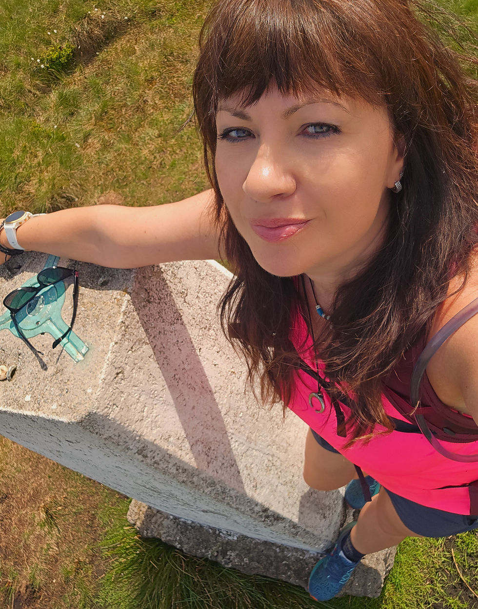
At Back Tor I dropped the bag and climbed up to the trig point. I'd previously considered skipping the scramble as been here many times before. That idea lasted until I arrived, because my brain cannot tolerate walking past a summit feature. 😂 Slapped my hand on the trig. 11 hours and 40 km. Ethel number 6 and trig number 4 for the day.
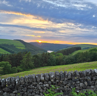
The final hour and a half along Derwent Edge was wonderful. Partly because the finish was getting closer. Partly because I finally had solid ground beneath my feet. The sun was setting over Bleaklow. That bleak landscape looked impossibly distant now. How did I cover all of this?
I kept turning around to watch the colours spread across the sky. Relief, satisfaction, a strong sense that I'd earned every kilometre.
🔍 Final Thoughts
I underestimated this challenge. Badly. I thought it would be similar to the Dambusters Challenge. It isn’t.
The Derwent Valley Skyline is mentally demanding in a completely different way. The navigation is relentless, the terrain is awkward, and the paths are often little more than suggestions. You are constantly asking yourself questions:
Is that the path? Was that the path?
Did I just walk off the path? Was there ever a path?
Is this bog solid? How do I get across that grough?
Am I drifting off course? Is that a sheep trod or an actual path?
How do I get out of this clough? What's over the next rise?
By the end, the distance almost felt secondary.
Garmin Fenix 6 recorded 46 km. Garmin GPSMAP 67i recorded 49 km. OS Maps recorded 53 km. All agreed on one thing: 12 hours and 40 minutes in elapsed time. Exactly how far I walked remains open for discussion.
What I do know is that I spent half a day wandering through some of the wildest terrain in the Peak District. The Lake District can be steep, exposed and physically brutal. The Dark Peak has a different personality. It doesn't fight you with cliffs and scree. Instead it slowly wears you down with distance, featureless terrain, bogs, navigation puzzles and an eerie sense of remoteness. It's like being dropped into a giant brown-green ocean where the waves are made of peat.
Do I recommend it? It is a brilliant route, but not a straightforward one. It is as much about navigation and mental resilience as it is about distance or summits. In good conditions it is manageable, even enjoyable in places, but it demands respect, patience, and a willingness to constantly reassess what the ground is telling you.
I would recommend it, but with caution. Go prepared, go with time on your side, and ideally go when the ground has been dry for a while. And above all, do not underestimate how quickly confidence can disappear in featureless moorlands.
Would I do it again? Only if somebody close to me needed emotional support on their first and last Derwent Valley Skyline.
Sometimes when your optimism is re-arranged you just have to keep going. Recalibrate, keep going again.
Peaks
⛰️ Crook Hill (382 m)
⛰️ Bridge-end Pasture (391 m)
⛰️ Alport Moor (535 m)
⛰️ Bleaklow Stones (630 m)
⛰️ Bleaklow Head (633 m)
⛰️ Hoar Stones - Howden Edge (514 m)
⛰️ Outer Edge (541 m)
⛰️ Margery Hill (546 m)
⛰️ Howden Edge (550 m)
⛰️ Back Tor (538 m)
⛰️ Dovestone Tor (505 m)
⛰️ White Tor (487 m)


Comments