
Black Hill, Sponds Hill and Unreachable Trig
- bootsandbanter

- Mar 15
- 4 min read
Two Ethels, One Trig and Four Enormous Cows
Date: 14 March 2026
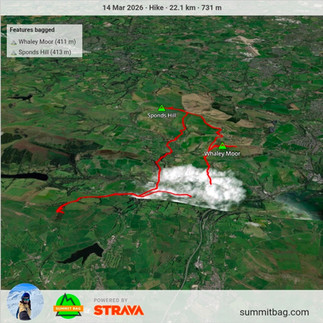
📍Route: Whaley Bridge → Black Hill (Ethel) → Sponds Hill (Ethel & toposcope + trig) → valley fields and cow encounter → Whaley Bridge → climb toward Ladder Hill (trig attempt) → Whaley Bridge
📏Distance: 25 km
⬆️Ascent: 800 m
⌛Time: 6 h 30 m
Weather: 5°C, sunny
Mood: Happy to be back in the hills, very intimidated by cows, super annoyed by private land.
Ethels: Black Hill (#76), Sponds Hill (#77)
Trigs: Sponds Hill (#62)
The Sun Finally Shows Up
After what felt like weeks of gloomy skies, the sun finally remembered the Peak District exists. I been watching the forecast all week, I had to go out.
I parked in a free car park in Whaley Bridge, which honestly felt like winning the lottery before the hike had even started. Nothing lifts a hiker’s spirits quite like a blue sign that says ‘Free Car Park’. And isn't this a rare thing.
So excited was I to be out that I forgot one tiny detail: starting my watch. Which might be OK for other people, but for someone as meticulous as me it was quite annoying. I only realised about twenty minutes later when I was already on top of the first hill. Brilliant. At least I had started the OS Maps recording, so the day wouldn’t disappear into the void entirely.
I do wonder how many other people out there start multiple apps for backups.
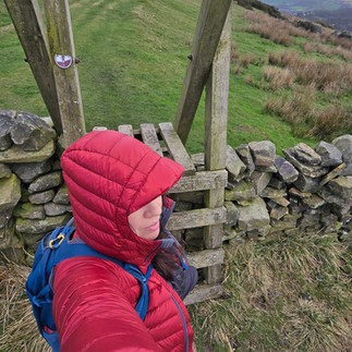
Black Hill: The Ditch That Is an Ethel
First objective was Black Hill. I slightly (!) diverted from the planned line because something on the ground looked like a better way to reach the Ethel. This was one of those rare occasions where my “that looks better” instinct actually worked.
The Ethel itself? Well… calling it underwhelming would be generous. It’s basically a ditch next to a drystone wall. If you didn’t have the app telling you it was there, you’d happily stroll past thinking it was just another dent in the earth.
As now I was confident my diversion skills are up to scratch, I briefly attempted a different descent back to the path. That turned out to be completely wrong and I was faced with drystone walls, so I retraced my steps. I like exploring is all I can say. But honestly, it was the first hour of the day, the sun was shining, and walking a bit more hardly felt like a tragedy.
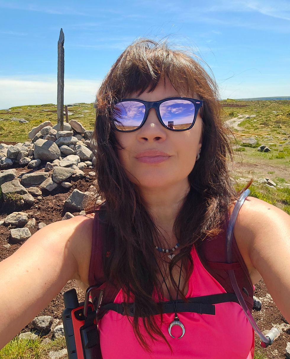
A Trig with a View and a Shiny Toposcope
Next up was Sponds Hill. The track leading to it is easy enough, though very muddy. The sheep clearly treat that path like their personal motorway, so you can imagine the state.
The ethel itself is marked by a shiny toposcope showing north, south, east and west with the surrounding peaks marked out. A proper summit gadget. The trig itself was hidden from the path, so I actually walked past it without realising.
It’s only about 400 metres from the Ethel. I hopped a locked fence and within about twenty metres of the gate there it was, painted white and standing proud with tremendous views stretching out toward Manchester.
The First Great Cow Standoff of 2026
Then came the first proper drama of the day.
Descending back into the valley, I found myself in a standoff with four absolutely massive cows standing directly on the path. Two metres away from me. Next to the drystone wall I had to go over. One of them, fully grown but behaving like a teenager, was enthusiastically pushing his head into the belly of what looked like his mum. This did not fill me with confidence.
Then he noticed me. And stared.
So I stared back. Inside my head I was thinking: Please just move… just f****** move…
For about ten minutes I stood there scanning every possible escape route. Unfortunately, there were just walls and barbed wire everywhere except the path currently occupied by the cows.
Eventually the cows shuffled slightly away from the wall but remained on the path about twenty metres away. Close enough to be concerning, far enough for a quick tactical manoeuvre.
So I went for it.
I scrambled around the side of the field, no paths, steep bits, eyes constantly glued to the cows while mentally calculating potential sprint directions if they decided to charge. Thankfully they stayed where they were, and I hurried to the far side of the field and climbed over the fence.
Honestly… bloody cows.
The Fortress of Ladder Hill
The final mission of the day was the Ladder Hill trig. This turned into a full saga.
I dropped back into Whaley Bridge and then had to climb ALL the way up again. The hill felt never ending, but by that point I’d already been walking about five hours non stop so I was still feeling fairly confident I’d bag the trig, even if it was on private land.
When I finally reached the top… signs everywhere.
Trespassers will be prosecuted.
Challenge accepted.
I tried three different access points. Three! Last attempt I got painfully close - I crawled under the branches of a tree that has fallen and broken part of the drystone wall...Seriously the stuff I am ready to do for those trigs, only to be stopped further down by massive walls that were completely impregnable.
To say I was annoyed is understatement. This added 8-9 km and almost 2 hours to my day. Bit the worst part is this is the last of the trigs in this area, and it is far from home.
But this isn’t over.
I will be back.
Next time I’ll try approaching Ladder Hill from the other side. The trig may have won this round, but the war is far from finished.
🔍 Final Thoughts
The day delivered sunshine, green fields, muddy paths, sheep, intimidating cows, a shiny toposcope, two more Ethels and trig #62.
Not a bad way to spend a sunny day in the hills.
Some people climb mountains. I mostly negotiate with livestock and argue with walls.
Peaks
⛰ Ethels bagged 77/95:
⛰️ Whaley Moor (411 m)
⛰️ Sponds Hill (413 m)
⛰ Trigs bagged 62/87:
⛰️ Sponds Hill (413 m)


Comments