Alphin Pike, The Trinnacle and Ashway Moss - completion of the Far North Fells

Three yoyo climbs, spectacular edges and an unplanned extra Ethel
Date: 10 May 2026
📍Route: Dovestone Reservoir > Alphin Pike (Ethel & trig) > Slack Head Brow > Greenfield village drop > Pots and Pans memorial > Saddleworth Moor edge > Saddleworth Trig > Dick Hill > Alderman’s Brow > Binn Green > Yeoman Hey & Dovestone Reservoir > Ashway Hey > Little Flat > Raven Stones Brow > The Trinnacle > Ashway Moss (Ethel)> Ashway Cross > Ashway Stone > Dean Rocks > Great Dove Stone Rocks > Sunny Brow descent > West Nab (bonus Ethel and trig)
📏Distance: 20 km
⬆️Ascent: 1028 m
⌛Time: 7 h
Weather: 7-10°C, sunny, cold
Mood: Curious and fully switched on
A circular Peak District route with stunning views from Dovestone Reservoir, over Alphin Pike (Ethel & trig) and Saddleworth Trig, across the dramatic Saddleworth Moor edges to The Trinnacle, then via Ashway Moss (Ethel), Dean Rocks and Great Dove Stone Rocks, finishing with a steep Sunny Brow descent and a bonus West Nab (Ethel & Trig) on the drive home..
A new corner of the Peak District
This hike took me to the far North Eastern Peak District. About 1.5 hours drive for me and somewhere I had never been before.
The moment I got out of the car at Dovestone Reservoir I already knew this was going to be a good day. The scenery immediately grabbed me. Dramatic hills rising either side of the reservoirs, sunshine, blue skies and a crisp morning air that makes you zip your jacket fully up while simultaneously feeling excited to start walking.
It was only about 7 degrees at 10 AM so the extra lightweight down jacket made an appearance. A sensible decision before a hike.
Straight into leg burner number one

The route I plotted headed first towards Alphin Pike through woodland and then sharply upwards towards Slack Head Brow.
The woods were beautiful. Birds singing, sunlight coming through the trees and views opening back towards the reservoir. I stood there admiring the dramatic hills surrounding me, little did I know I would later walk all over them anyway lol.
Then came the climb.
Pretty steep. Very steep actually.
I designed this route basically as a giant yoyo. Every time I gained height, the route immediately was throwing me back into another valley before demanding the next climb. Alphin Pike was merely leg burner number one.
I know how these things go by now so pacing myself became the strategy very early on.
Alphin Pike, trig number 69 and an immediate descent punishment

I saw nobody until Alphin Pike itself.
This summit became Ethel number 82/95 and Trig number 69/87.
Over 300 m of elevation gained in around 2.5 km definitely woke the legs up properly.
The views towards Manchester were fantastic though and the weather was absolutely helping. Clear skies make everything feel easier. I really liked this summit, one of the best ones really.
Naturally, after all that climbing, the route immediately dumped me all the way back down towards Greenfield village lol.
From around 470 metres down to about 156 metres. I truly believe suffering builds character.
The surprise of Pots and Pans

After crossing Greenfield I headed up the other side towards the Pots and Pans memorial.
I had not researched the area beforehand, so I had absolutely no idea this place was coming. Honestly, I loved that. One of my favourite things about hiking is stumbling into unexpected places that suddenly become one of the highlights of the day.
And this memorial really was spectacular.
The setting, the views, the atmosphere, the shape of the hills around it, the height of the stone structure, it all works. One of those places that are quite memorable.
Saddleworth Moor and giant horizons
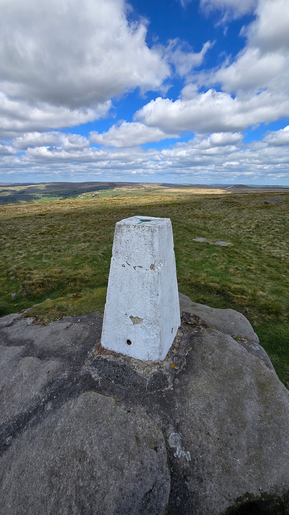
From the memorial I continued towards Saddleworth trig. Trig number 70.
This one stands quite independently so I specifically wanted to get it done as part of this hike rather than forcing it awkwardly into another route later.
And this whole section was just glorious.
Tracing the edge of Saddleworth Moor with huge views stretching towards Manchester, Liverpool and even Snowdonia in the distance. The weather was absolutely carrying the mood too. Warm in the sun, sheltered from the wind and nobody around.
The out-and-back to Saddleworth trig felt peaceful and expansive. I am glad I added this on.
Alderman’s Hill and one of the best views of the day

After Saddleworth trig I headed towards Dick Hill and Alderman’s Hill.
Then suddenly the edge appeared.
Wow. The panoramic views over Dovestone and Yeoman Hey Reservoirs were spectacular. Proper dramatic landscape stuff.
Descending Alderman’s Brow was steep enough to fully get the attention of my knees, but when I looked back up afterwards I genuinely loved the shape of the hill behind me. Some hills just have presence. This was one of them.
At the bottom of the steep climb a foreign guy with very limited English stopped me and asked: “How long to top?”
I looked up and said, “Ten minutes, don’t worry.”
To be fair, I knew it would probably take me about ten minutes because I weirdly play this game with myself all the time. I stand at the bottom of a hill, estimate how long it will take me to climb it and then see how accurate I was afterwards.
Strangely, I am usually within about 3 or 4 minutes of the guess.
Clearly years of hill suffering have unlocked some sort of internal mountain timing calculator. I did wonder what that guy thought once he was at the top about my casually thrown estimation. lol

My tiny-step climbing theory
After crossing the A635 and dropping towards Binn Green car park, I passed between Yeoman Hey Reservoir on one side and Dovestone Reservoir on the other before starting the final major climb of the day towards Ashway Hey.
At this point I already knew this was climb number three and I also knew exactly what strategy I was sticking with.
Small steps. No stopping. Open chest, don't slump your shoulders and just keep moving.
I have really noticed how much difference this makes. I watched a group of younger lads ahead of me attacking the climb with big powerful steps and faster bursts. They would then stop and sit down, start again, I passed them, then they nearly catch me, then they stopped again.
Meanwhile I just kept slowly (for me) plodding upwards and eventually I lost them completely.
I am definitely not some movement expert but honestly, I think smaller consistent steps make a huge difference on sustained climbs. Especially when you are already over 1000 metres of elevation into the day.
The quieter route towards The Trinnacle

My plotted route took me over Little Flat rather than the busier Ashway Rocks line.
In fact, I saw absolutely nobody on this section.
I was heading towards the infamous Trinnacle.
Then once I reached Raven Stones Brow the whole landscape exploded open again. Spectacular views over Saddleworth Moor and Greenfield Reservoir while walking right along the edge.
The Trinnacle itself is brilliant. Such a dramatic rock formation.
When I first arrived, nobody was actually on it. A rare moment apparently. A few people were nearby gearing themselves up to climb onto it, so I quickly grabbed a video while it was completely empty before the summit photoshoot queue began.
I sat there eating my sandwich while watching people climb onto it. Huge drops either side, drones buzzing about, people climbing on top and staying there forever taking photos.
I decided against going up myself this time.
Not because I do not want to, I definitely do, but the whole thing felt slightly too much like a live event with spectators and drone footage involved lol.
I will absolutely come back another time though. Early morning seems the correct strategy before the drone pilots awaken.
Ashway Moss and secret Ethel hunting
After The Trinnacle I headed towards Raven Stones and Ashway Moss. The moorland was actually surprisingly dry-ish.
Eventually I reached a very large cairn, but I already knew the true summit was not there. Out came the Ethel app.
To get the actual summit you basically have to zoom in 100% and follow the tiny direction marker about 100 m SE of the cairn to a completely unmarked spot. Photo taken. Summit secured. Not very memorable at all. Ethel number 83.
Then onwards towards Ashway Cross and Ashway Stone before crossing a brook and reaching Dean Rocks.
And honestly, Dean Rocks became another massive highlight of the day.
The rock formations there are fantastic and with the clear weather the views were incredible. I actually found myself wishing I had someone there just to take one decent photo of me standing dramatically on the edge of the rocks for once lol.

“Is it worth it?”
From Dean Rocks I continued towards Great Dove Stone Rocks before beginning the final steep descent down Sunny Brow.
Near the bottom two lads, probably about 16 or 17, stopped me looking absolutely shattered already.
“Is it worth it?” one asked. I said, “Depends what you’re looking for really. The views are great and there are some pretty awesome rocks.”
Then they asked how long to the top.
I looked upwards. “That? Ten minutes max lol.”
Now… that was definitely my ten minutes. Possibly not theirs. But they were young enough to just get on with it.
That was the second time I’d been asked something like that on this day (and second time I gave the same estimate lol), which made me wonder if I just look like a walking Peak District information board at this point.
Ice cream and the fake ending
Back at the car park I rewarded myself with an ice cream.
Perfect end to a brilliant hike.
Or so I thought.
I got into the car and started driving home. About 77 miles to go. Around 2 miles into the drive I suddenly remembered something.
There was another Ethel and a trig nearby. The final Far North Ethel.
I could not properly check while driving but I vaguely knew where it should be. So about six miles later I pulled off the A635, checked the map and there it was.
West Nab. Close enough.
Naturally I parked on the side of the road and headed off for another 3 km there-and-back bonus hike lol. Ethel number 85 and trig number 71.
And just like that:
The Far North Ethels: COMPLETE
Ironically, this is the shortest Ethel region with only 10 hills, and I always assumed it would probably be the last region I completed because it is one of the furthest away from home.
Funny how expectations work.
All it takes is accidentally driving past the final hill.
Apparently I still had energy left
The strangest part?
After sitting and driving in the car for about 15 minutes I actually felt refreshed again.
On the way down from West Nab I even started running downhill for no real reason whatsoever. Or maybe I did cause I had no backpack. Light as a feather.
Happy as Larry as long as hills are climbed and descended. 🥾
🔍 Final Thoughts
There is something about the beauty of unexplored places in all of this.
On paper, it is just 2D planning on a map. Lines, contours, little decisions about direction. But the reality is always 4D, unfolding in real time, shaped by weather, legs, mood, and surprise viewpoints that never quite exist in your head properly beforehand.
I rarely truly know what a route will feel like in real life until I am standing in it.
And that is why I still get that same feeling at the start of a hike and then later, somewhere halfway through, I find myself slightly amazed that I actually walked all of it. That the lines I traced in theory became something I physically moved through.
It is a strange kind of disbelief, like remembering you once wrote yourself a puzzle and then watching yourself solve it without quite noticing when it happened.
Maps show the path, but feet discover the story, and I always end up surprised by the world I already planned to walk.
Peaks
⛰️ Alphin Pike (470 m) - ethel N82
⛰️ Broadstone Hill (455 m)
⛰️ Ashway Moss (497 m) - ethel N83
⛰️ West Nab (501 m) - ethel N84
📍 Alphin Pike, trig N69
📍 Saddleworth, trig N70
📍 West Nab, trig N71
The route Pots and Pans memorial Ashway Cross Ashway Moss cairn Dovestone Reservoir The Trinnacle


Comments